
Northeast Drought Update
Posted September 3, 2026
U.S. Drought Monitor
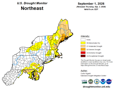
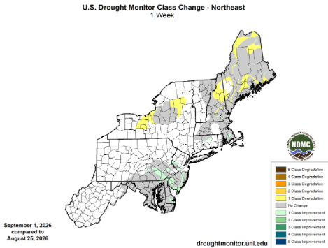
Once again this week, conditions continued to improve in the Mid-Atlantic and southern New England but deteriorate in northern New England and sections of upstate New York. For example, extreme drought was erased from the Northeast and severe drought was removed from New Jersey, while moderate drought and abnormal dryness contracted in the region’s southeastern corner. However, severe and moderate drought expanded in Maine, while abnormal dryness grew in coverage in Maine, New Hampshire, and New York. The U.S. Drought Monitor released on September 3 showed 0% of the Northeast in extreme drought, 3% in severe drought, 15% in moderate drought, and 25% as abnormally dry compared to less than 1%, 2%, 14%, and 23%, respectively, last week. Noticing impacts from dry conditions in your area? Reports can be submitted online via the Condition Monitoring Observation Reports (CMOR) website.
For more information on drought in NY & New England see the Northeast DEWS Dashboard and to learn more about assessing drought in the United States watch this video.
Precipitation
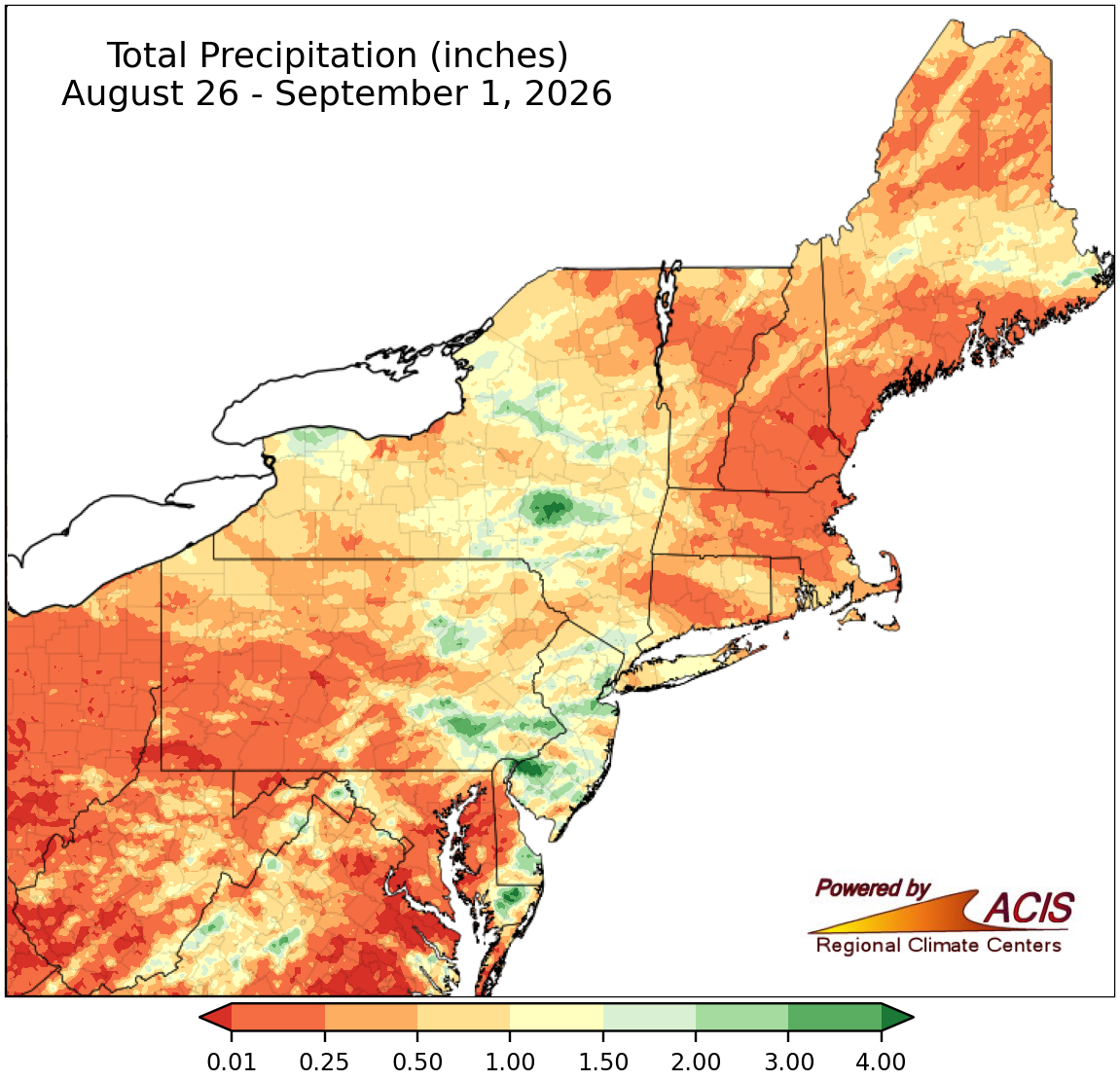
Total precipitation for the last week.
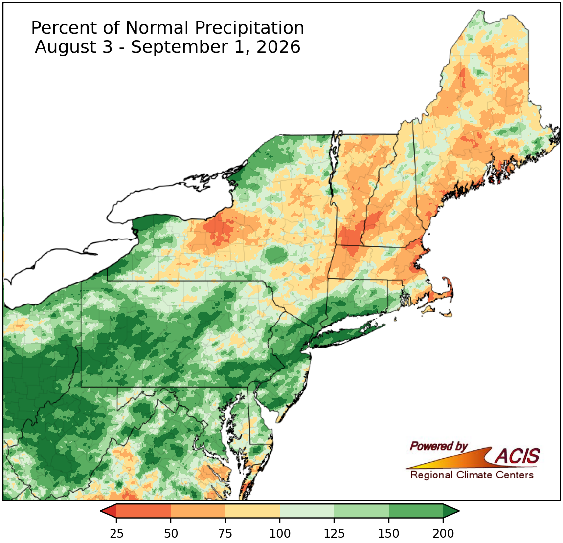
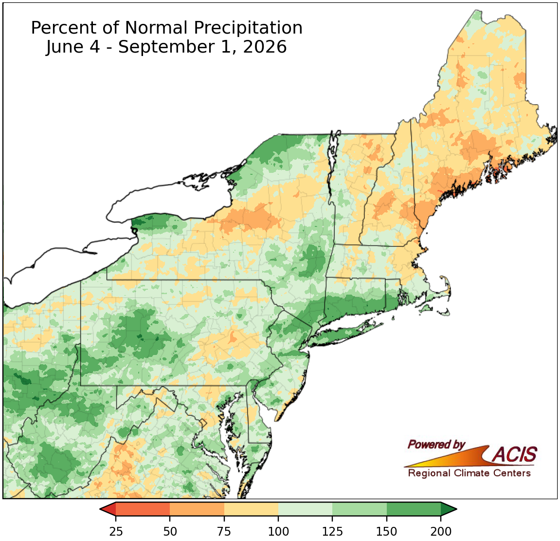
Percent of normal precipitation for the last 30-day and 90-day periods.
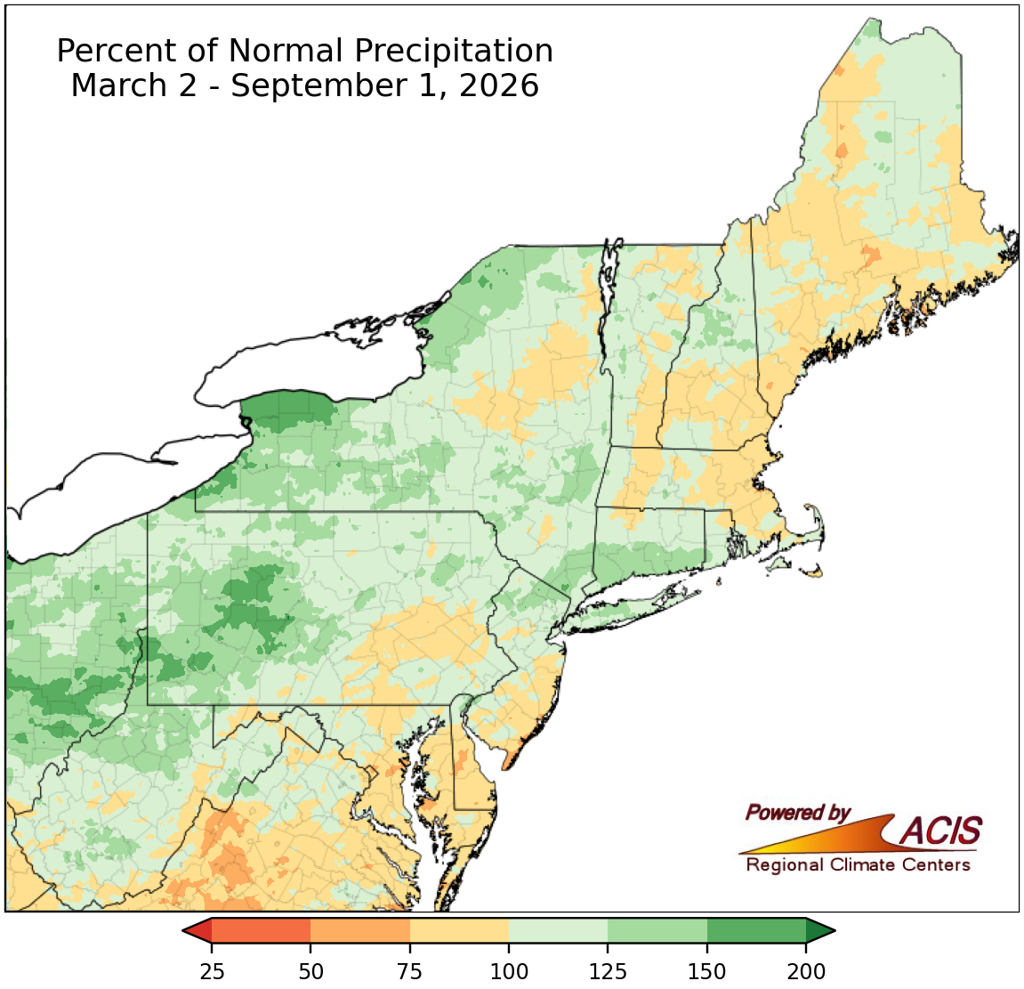
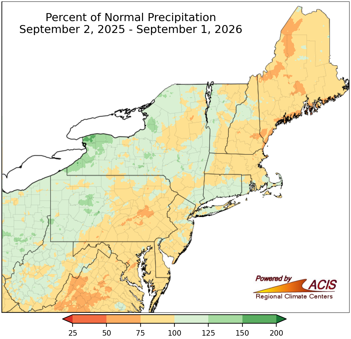
Percent of normal precipitation for the last 6-month and 1-year periods.
Water Resources
As of September 1, USGS 7-day streamflow ranged from record low in a few spots including Maine and central Maryland to record high in a couple of locations like western Pennsylvania. USGS groundwater levels as of September 1 generally ranged from record low in several areas including southern Maryland, parts of New Jersey, southeastern Massachusetts, and southern Maine to record high in spots like western Pennsylvania, western New York, and southwestern Connecticut. There have been a few reports of dry wells in Maine. Water conservation continued to be encouraged in multiple locations, with some communities like having mandatory water restrictions.
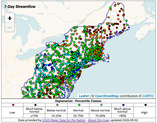
7-day average streamflow compared to historical streamflow from USGS WaterWatch
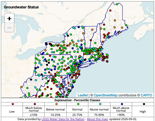
A network of wells to monitor the effects of droughts & other climate variability on groundwater levels. USGS Groundwater Data
Agriculture
Conditions reports from northern Maine noted some plants are stunted, leaves are falling from trees prematurely, water levels are lower than usual, and soils are dry. In Maine, some growers reported slow hay growth and/or reduced yields of crops like garlic and peppers.
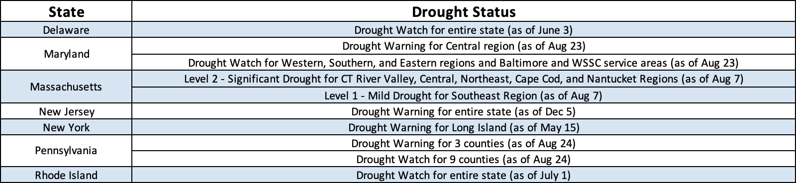
State Declarations
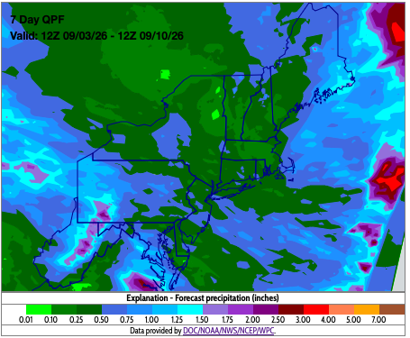
Outlooks
Seven-day precipitation amounts are forecast to range from a tenth of an inch to two inches. The highest amounts are expected in West Virginia and southwest Pennsylvania as unsettled weather over the next few days bring showers and thunderstorms.
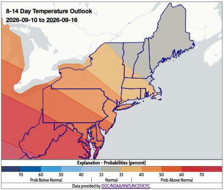
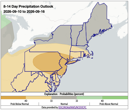
NOAA’s Climate Prediction Center (CPC) 8-14 day outlook for September 10-16, 2026 favors near-normal to above-normal temperatures with probabilities increasing towards West Virginia. The outlook favors near-normal to below-normal precipitation.
The maps on this page, and additional drought resources, can also be found on the Northeast DEWS Dashboard.
About Northeast Drought
This page offers drought information by state, with links to regional and national drought web pages.