
Northeast Drought Update
U.S. Drought Monitor
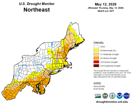
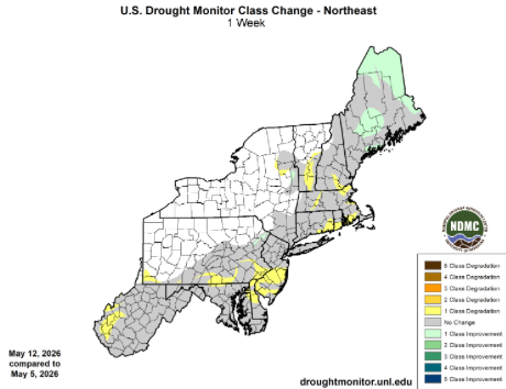
For more information on drought in NY & New England see the Northeast DEWS Dashboard and to learn more about assessing drought in the United States watch this video.
Precipitation
Water Resources
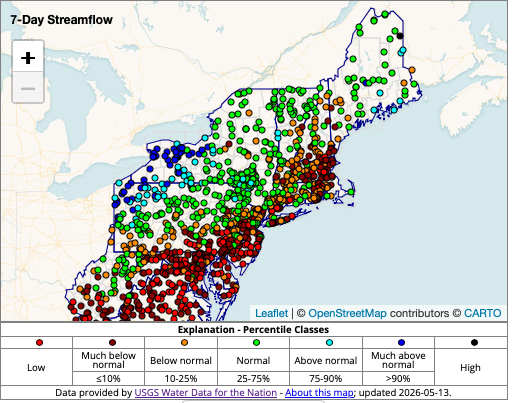
7-day average streamflow compared to historical streamflow from USGS WaterWatch
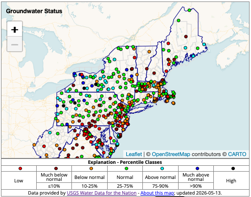
A network of wells to monitor the effects of droughts & other climate variability on groundwater levels. USGS Groundwater Data
Agriculture
Reports from West Virginia noted drought-related impacts including giving livestock hay or supplemental feed due to poor pasture conditions and limited regrowth, reduced water levels in ponds and streams resulting in hauling water for livestock, dry soils leading to planting delays, and slow growth of row crops. A report from southeastern West Virginia noted winter wheat had to be harvested early and yield was reduced by 40% compared to a typical year. A grower in eastern West Virginia is expecting their hay yield to be reduced by half.
State Declarations

Outlooks
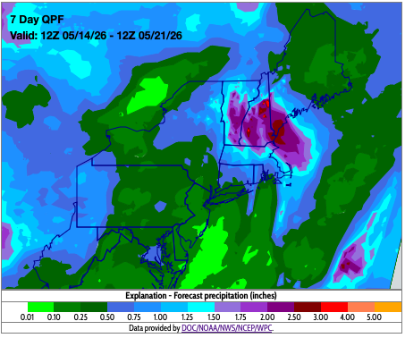
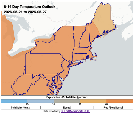
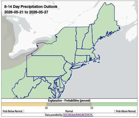
The maps on this page, and additional drought resources, can also be found on the Northeast DEWS Dashboard.
About Northeast Drought
This page offers drought information by state, with links to regional and national drought web pages.