
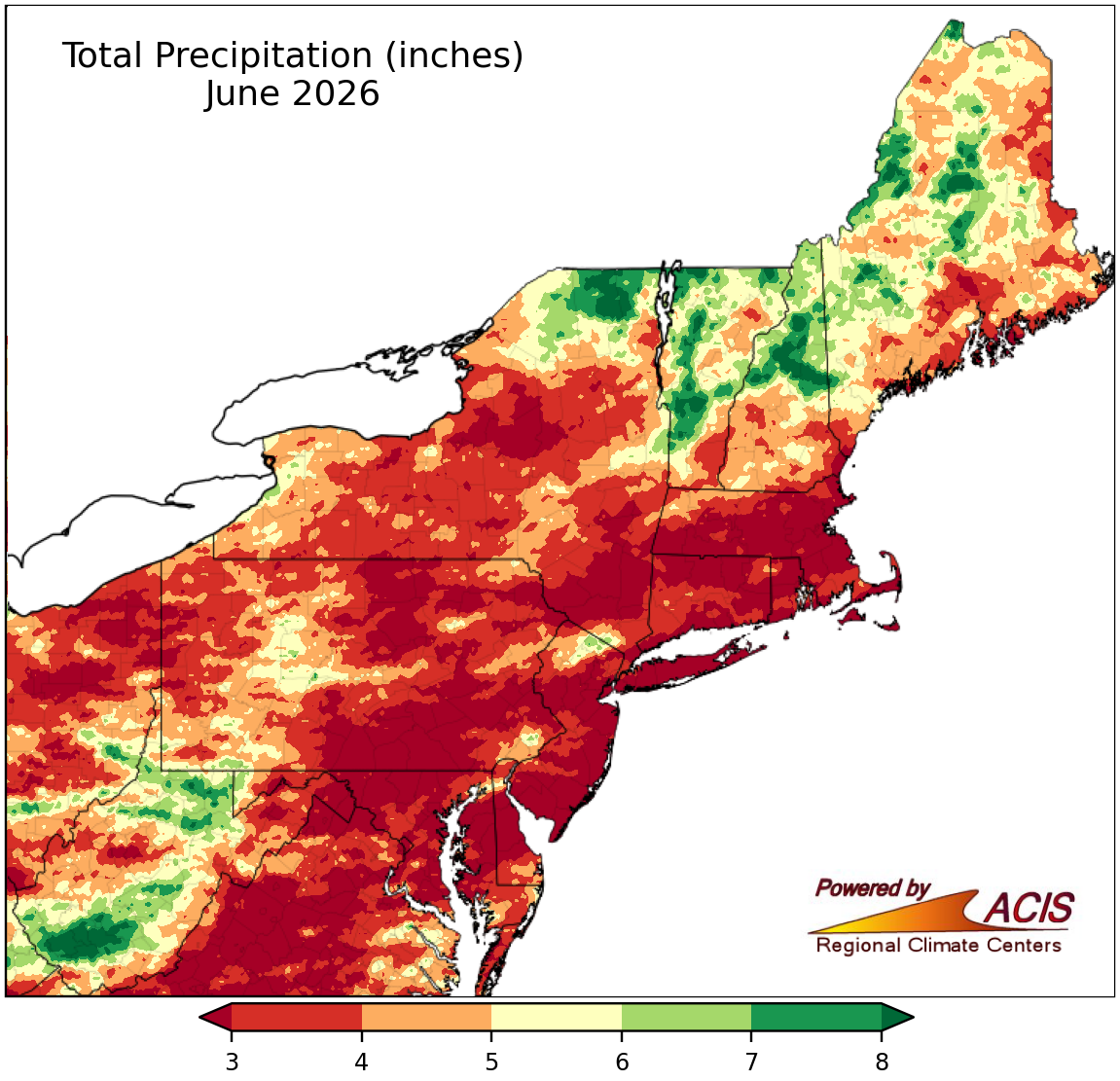
Variable to map:
---
---
---
---
---
About State and Regional Maps
This map represents ACIS climate data interpolated to a 5km by 5km grid. Additional information about ACIS can be found on the ACIS web page. These maps are created at 7:00 am on the 3rd day after the end of each month and updated several times during the course of the month as additional data become available.